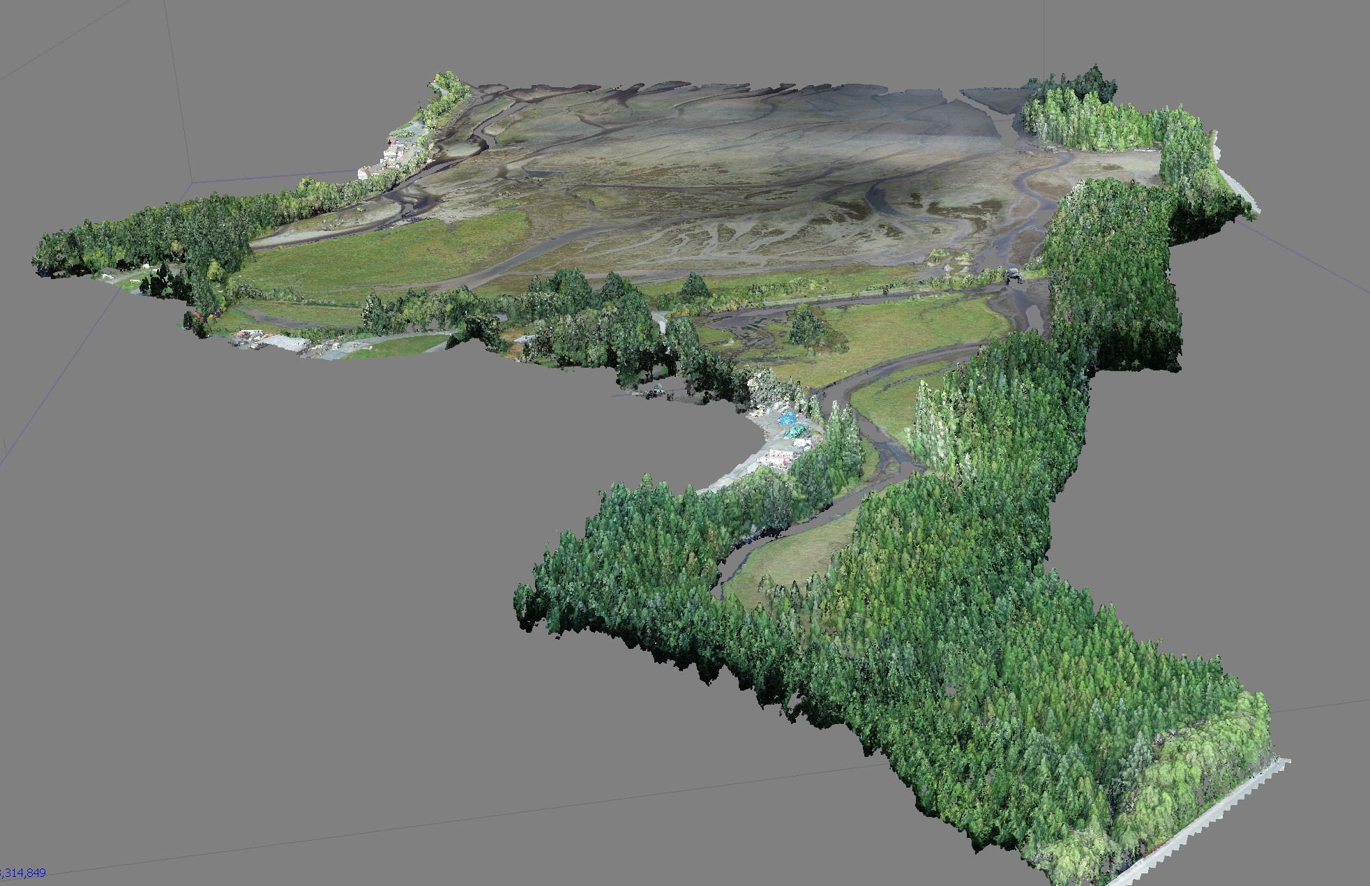
Precise Survey and Mapping
We offer comprehensive survey and mapping tools including LiDAR, photogrammetry, multispectral imagery and RTK ground surveys.
Photogrammetry and Multispectral
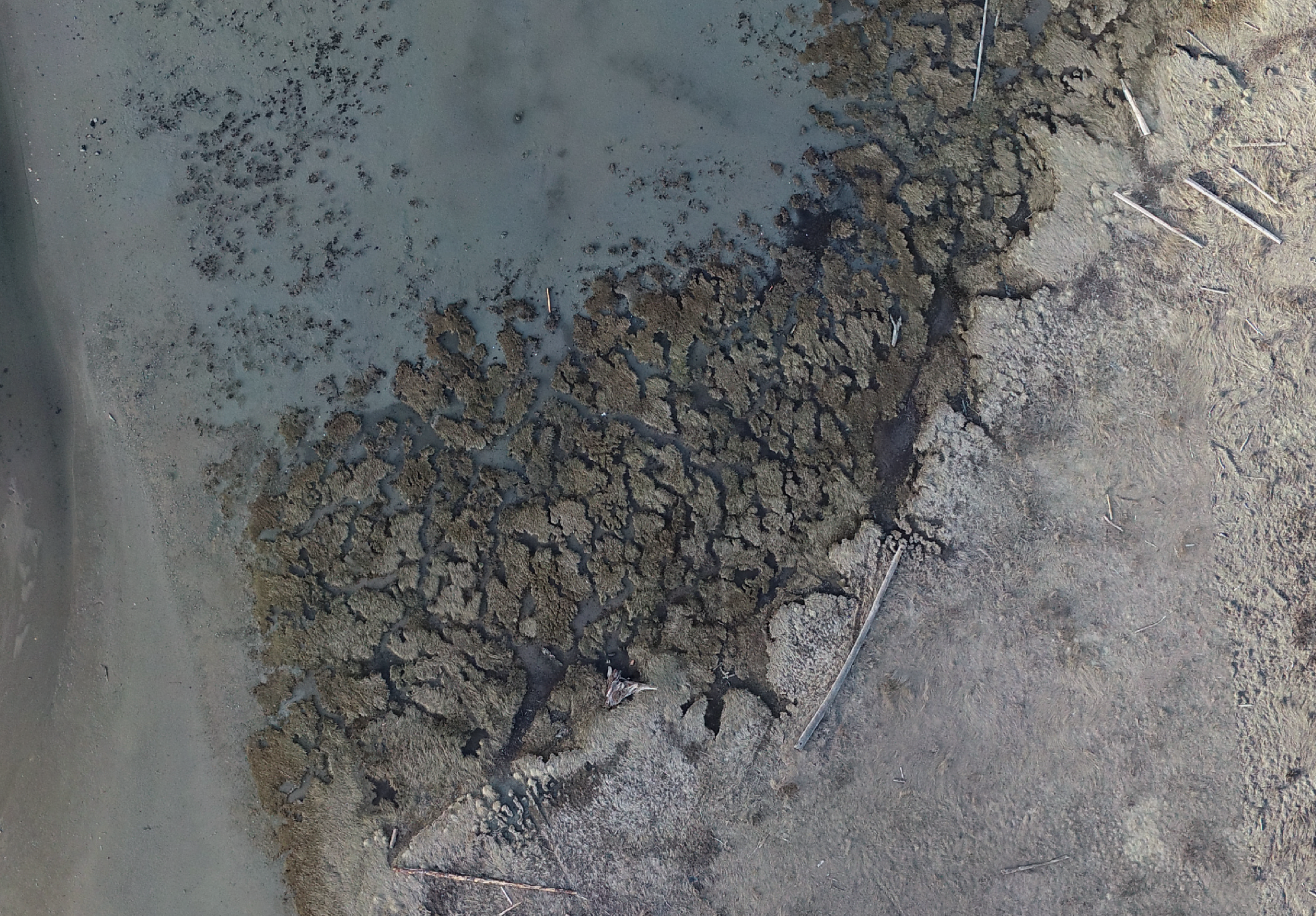
Photogrammetry is used to monitor ecosystems, farms and construction sites. This technique permits centimetre-level measurements to be taken from images with high visual fidelity or on an interactive map. It provides very accurate elevation data on open terrain. When done using a multispectral camera, photogrammetry provides insights on areas of plant health/stress before it becomes apparent to the naked eye.
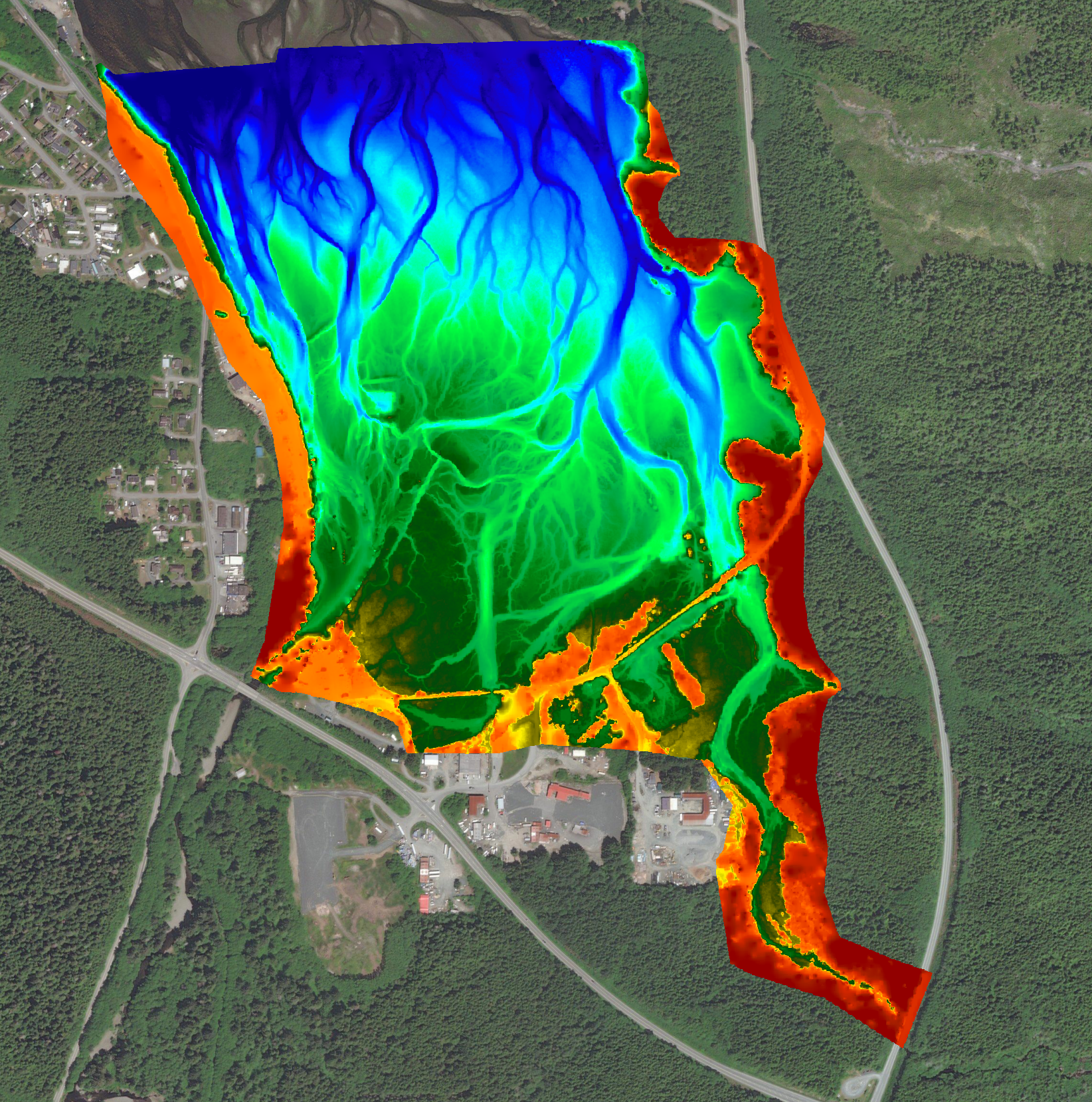
Digital Elevation Models
Digital Elevation Models (DEMs) can be used for calculating cut/fill volumes for environmental restoration projects, monitoring erosion/accretion, and planning for sea level rise. DEMs allow you to measure surface topography at up to 5cm precision and resolution.
LiDAR
LiDAR is used for mapping elevation beneath vegetation cover. The “bare earth” elevation of forest floors, farmland or marshes that is hidden below vegetation can be obtained at high precision. LiDAR is used for planning construction sites, environmental restoration works, assessing flood risk, or mapping infrastructure.